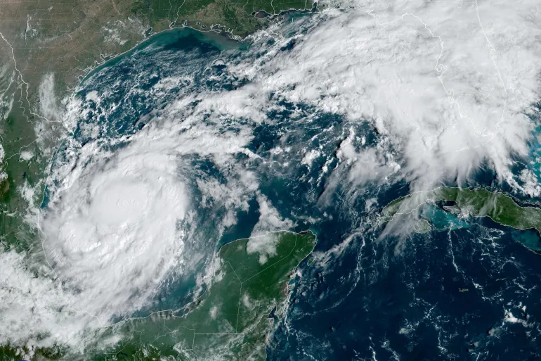
Hurricane Milton is set to hit Florida late on Wednesday night or early Thursday morning, with the National Hurricane Center (NHC) labeling it an “extremely dangerous major hurricane.” Landfall is expected around 02:00 EDT (07:00 BST) on Thursday, near Tampa, Florida. The city and its surrounding metropolitan area of over three million people are preparing for what could be the worst storm in a century.
Forecasters are warning of torrential rain, flash flooding, destructive winds, and potentially deadly storm surges along the Gulf Coast. Water surges of 10-15 feet (3-4.5 meters) and localized rainfall of up to 1.5 feet could lead to severe flooding in some areas.
Milton was about 300 miles (485 kilometers) southwest of Tampa as of Wednesday morning, with sustained winds of 160 mph (260 km/h). Although it reached the most powerful Category 5 status earlier, it is expected to slightly weaken before striking Florida.
Florida Governor Ron DeSantis has ordered mass evacuations along the state’s west coast, warning that a “monster” storm is approaching. Airports are closing, shelters are being prepared, and authorities are urging residents to leave for safety.
Forecasters are also warning of potential tornadoes that could develop across central and southern Florida as a result of scattered thunderstorms triggered by the hurricane.
Hurricane Milton, which passed near Mexico’s Yucatan Peninsula earlier in the week, is expected to sweep across Florida and move into the Atlantic Ocean by Thursday morning. Authorities are calling this one of the most dangerous storms in recent memory, urging residents to prepare for significant disruptions.


